CFC 2004 Routes
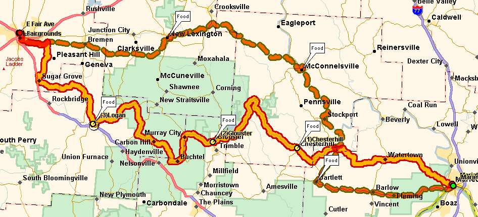
| The 29th running of the Columbus Fall Challenge ran between
Lancaster and Marietta, Ohio on some of the most rugged terrain Ohio can
muster. It's generally downhill all the way to Marietta but
there are so many bumps along the way that it doesn't seem to matter!
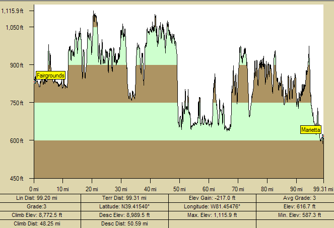
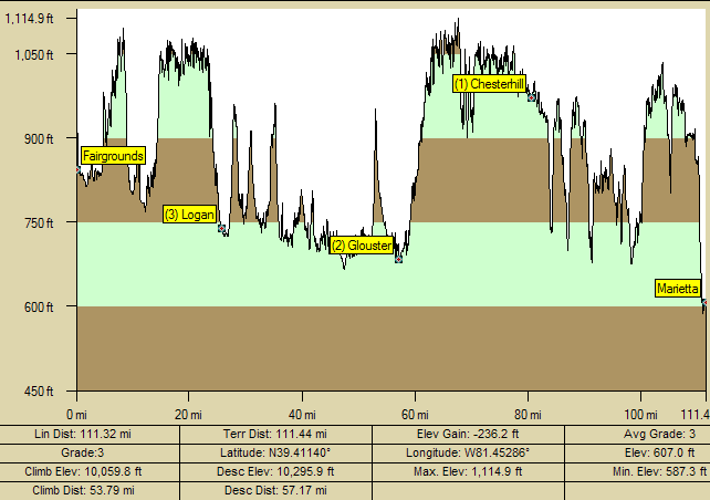
These profiles show the many changes in elevation as well as the overall
gains and losses in elevation over the two day tour. These profiles show the elevation of each day's ride and were generated with XMap 4.5 and Topo USA by DeLorme. The profiles are extremely accurate and because of the accuracy and the scale, hills often look like mountains. Use the picture, the elevation readings on each chart, and the statistics at the bottom of each to best judge each day's ride. |
 |
Saturday October 3 |
Sunday October 4
|
|
All mapping courtesy of Geographic
Insights, a Lansing based firm specializing in market analysis,
management systems, and geographic displays. Images may be freely
shared with attribution to Geographic Insights (Including a hyperlink if
displayed on a web page). |